notes.husk.org/likes
images.
similar to
15364182234
.
24 images, most alike first.
aerial view
satellite imagery
cityscape
top-down view
vacant lots
real estate
urban planning
suburban area
land use
property maps
Notational
aerial view
parking lot
cars
top-down view
pattern
vehicles
logistics
grid
massive scale
distribution center
Dan W, Software Developer
10 images
ed ruscha
book
photography
LESS IS MORE
6 images
aerial view
top-down view
patterns
infrastructure
transportation
symmetry
geometric pattern
cityscape
logistics
scale
hyperreal cartography & the unrealized city
4 images
arizona
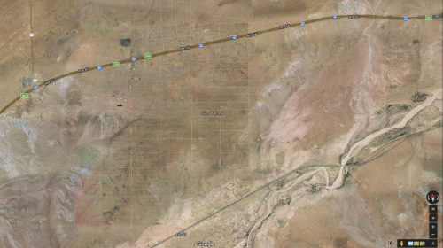
sun valley
urbanism
grids
hautepop
aerial view
black and white
cityscape
vintage photograph
architecture
neighborhood
city grid
historical view
Tecznts
aerial view
satellite imagery
suburban landscape
residential area
housing development
top-down view
urban planning
neighborhood
infrastructure
street pattern
Daily Overview
aerial view
landscape
agriculture
fields
canal
digital art
mosaic
geometric pattern
abstract
top-down view
Dan W, Software Developer
satellite imagery
aerial view
urban area
residential neighborhood
street map
cityscape
top-down view
neighborhood layout
infrastructure
architecture
The New Aesthetic
2 images
aerial view
satellite imagery
heatmap
parking lot
black and white
data visualization
urban planning
cartography
density map
Dan W, Software Developer
shipping containers
cargo port
aerial view
logistics
maritime
supply chain
freight
container terminal
industrial
shipping yard
The New Aesthetic
aerial view
aircraft storage
airplane boneyard
satellite imagery
aviation
desert
aircraft graveyard
top-down view
pattern
planes
Daily Overview
aerial view
satellite imagery
industrial park
warehouse district
commercial area
top-down view
infrastructure
cityscape
logistics center
Daily Overview
aerial view
bus depot
parking lot
white buses
transportation
top-down view
public transport
vehicle fleet
mass transit
pattern
Daily Overview
google search
mapquest
2001
retro internet
digital maps
cartography
internet history
vintage web
search engine
web design
Tecznts
satellite imagery
aerial view
coastal town
urban grid
waterfront
cityscape
top-down view
port
infrastructure
coastline
Daily Overview
9 images
aerial view
oil pumpjack
satellite imagery
desert
industrial landscape
oil extraction
arid terrain
top-down view
energy industry
earth tones
Notational
7 images
shipping containers
cargo port
aerial view
container terminal
maritime
logistics
gantry cranes
supply chain
shipping yard
industrial
Engineering Dept.
7 images
aerial view
suburban neighborhood
residential area
planned community
urban planning
patterned streets
housing development
concentric patterns
desert
Advanced Methods for Geospatial Image Analysis
2 images
kfc
google satellite
ch-ch-changes
the satellite tourist
life
what is this even
aerial view
suburb
residential area
neighborhood
housing development
top-down view
urban planning
suburban landscape
residential community
township
Daily Overview
aerial view
suburban neighborhood
residential area
houses
rooftops
cityscape
street pattern
suburbia
housing development
Daily Overview
aerial view
industrial landscape
residential area
storage tanks
oil depot
urban planning
top-down view
cityscape
infrastructure
land use
Daily Overview