notes.husk.org/likes
images.
similar to image 2 of
92646395339
.
24 images, most alike first.
aerial view
suburban neighborhood
residential area
houses
rooftops
cityscape
street pattern
suburbia
housing development
Daily Overview
aerial view
satellite imagery
urban planning
circular pattern
radial design
planned community
geometric pattern
suburban landscape
residential development
Daily Overview
6 images
aerial view
top-down view
patterns
infrastructure
transportation
symmetry
geometric pattern
cityscape
logistics
scale
hyperreal cartography & the unrealized city
aerial view
satellite imagery
suburban landscape
residential area
housing development
top-down view
urban planning
neighborhood
infrastructure
street pattern
Daily Overview
aerial view
satellite imagery
industrial park
warehouse district
commercial area
top-down view
infrastructure
cityscape
logistics center
Daily Overview
aerial view
parking lot
cars
top-down view
pattern
vehicles
logistics
grid
massive scale
distribution center
Dan W, Software Developer
5 images
i love this city
my home (even if i continue to feel like unwelcome 'techie scum')
adore how crisp and bright this picture is -- you can see my apartment!
Simply Sithel
aerial view
black and white
cityscape
vintage photograph
architecture
neighborhood
city grid
historical view
Tecznts
aerial view
cityscape
urban planning
radial design
geometric pattern
top-down view
street layout
architecture
city grid
Daily Overview
aerial view
industrial landscape
residential area
storage tanks
oil depot
urban planning
top-down view
cityscape
infrastructure
land use
Daily Overview
7 images
shipping containers
cargo port
aerial view
container terminal
maritime
logistics
gantry cranes
supply chain
shipping yard
industrial
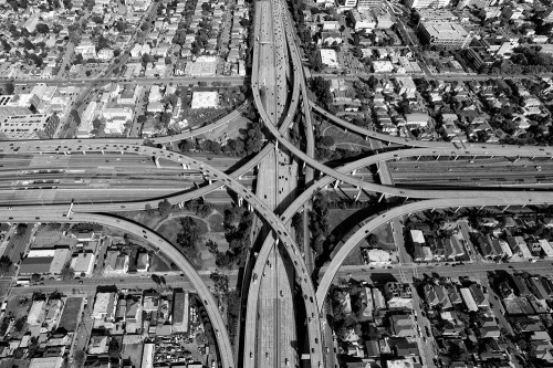
Engineering Dept.
aerial view
highway interchange
infrastructure
urban planning
transportation
road
spaghetti junction
civil engineering
top-down view
trafficway
Daily Overview
aerial view
parking lot
cars
top-down view
automobiles
pattern
river
car storage
Daily Overview
a day in the life of america
archive death drive
abstract
city map
geometric pattern
digital art
architectural design
top view
minimalism
cityscape
grid
Tecznts
10 images
visual apparel
van styles
s.f.
san francisco
leica monochrom
Stephen Vanasco Photography
highway interchange
aerial view
infrastructure
transportation
road
freeway
urban planning
satellite imagery
overpass
highway system
markasaurus
aerial view
suburb
residential area
neighborhood
housing development
top-down view
urban planning
suburban landscape
residential community
township
Daily Overview
aerial view
waterfront living
canal community
suburban landscape
urban planning
residential area
top-down view
waterways
geometric pattern
Daily Overview
aerial view
airport
runway
aviation
terminal
transportation
top-down view
infrastructure
aircraft
Daily Overview
6 images
new york city
central park
skyline
skyscraper
urban planning
3d rendering
shadow study
cityscape
foreverdigital
aerial view
airport
runway
satellite imagery
cityscape
top-down view
aviation
infrastructure
residential area
Daily Overview
constant
constant nieuwenhuys
new babylon
urbanism
architecture
situationism
LESS IS MORE
houston
aerial view
urban sprawl
parking lots
cityscape
car culture
urban planning
landscape
infrastructure
Joshua Nguyen