notes.husk.org/likes
images.
similar to
140382614595
.
24 images, most alike first.
historical map
san francisco history
vintage cartography
california gold rush
19th century
yerba buena
urban history
old san francisco
california history
fuck yeah cartography!
3 images
historical map
puget sound
washington state
seattle area
bainbridge island
infrastructure planning
cartography
proposed bridges
pacific northwest
hyperreal cartography & the unrealized city
prospect park
brooklyn
cartography
historical map
city map
urban planning
cadastral map
landscape map
Tecznts
chicago
historical map
urban planning
transit system
1909
subway
elevated train
cartography
vintage diagram
railroad stations
hyperreal cartography & the unrealized city
urban planning
city
map
hartford
conneticut
hyperreal cartography & the unrealized city
aerial view
parking lot
cars
top-down view
pattern
vehicles
logistics
grid
massive scale
distribution center
Dan W, Software Developer
6 images
new york city
central park
skyline
skyscraper
urban planning
3d rendering
shadow study
cityscape
foreverdigital
topographic map
historical map
california
los angeles
cartography
usgs
geography
san fernando valley
BATTERED SHOES
3 images
calgary
architecture
pedestrians
system design
Frankie Roberto
2 images
historical map
london map
cartography
1915
urban topography
street map
river thames
city plan
STML
new york city
historical map
vintage cartography
nyc history
cartography
engraving
urban geography
archival
hyperreal cartography & the unrealized city
urban planning
city map
architectural drawing
cartography
graphic map
site plan
map illustration
urban layout
diagrammatic art
Tecznts
abstract
city map
geometric pattern
digital art
architectural design
top view
minimalism
cityscape
grid
Tecznts
san francisco
bart
unbuilt subway
1960
urban planning
transit
subway
hyperreal cartography & the unrealized city
3 images
hyperreal cartography & the unrealized city
2 images
google books
digitization
art
lit
tech
books
folded
obscured
maps
cartography
england
old books
rare books
used books
book arts
library
libraries
The Art of Google Books
aerial view
satellite imagery
industrial park
warehouse district
commercial area
top-down view
infrastructure
cityscape
logistics center
Daily Overview
satellite imagery
aerial view
coastal town
urban grid
waterfront
cityscape
top-down view
port
infrastructure
coastline
Daily Overview
6 images
aerial view
building segmentation
cityscape
urban analysis
3d reconstruction
data visualization
new york city
geospatial data
computer vision
digital twin
Notational
chicago history
electric vehicle history
1916
transportation history
historical map
automotive history
infrastructure history
commonwealth edison
early electric cars
things magazine tumblr
detroit
aerial view
urban planning
data visualization
city map
downtown detroit
parking map
urban infrastructure
satellite imagery
city layout
Notational
5 images
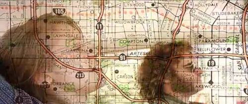
movie still
double exposure
flood
cinematic
los angeles map
superimposition
disaster
submerged
visual effects
Buzz Andersen
historical map
aerial view
paris
cityscape
engraving
cartography
architecture
vintage
seine river
Tecznts
maps
subways
historical
new york city
Department of Design