notes.husk.org/likes
images.
tagged aerial photography.
page 1 of 2 with 43 images.
abstract
black and white
aerial photography
landscape
texture
monochrome
mountains
nature
high contrast
pattern
Tecznts
aerial photography
satellite imagery
cityscape
urban landscape
coastline
top-down view
waterfront
urban grid
blue tones
shoreline
Daily Overview
london
70s
aerial photography
Neon Dust
aerial photography
agricultural landscape
abstract patterns
topographic view
farmland
drone shot
terraced fields
earth tones
texture
cultivated land
Daily Overview
aerial view
parking lot
cars
top down
bird's eye view
automobiles
pattern
river
car storage
aerial photography
Daily Overview
aerial view
waterfront living
canal community
suburban landscape
urban planning
residential area
top-down view
waterways
geometric patterns
aerial photography
Daily Overview
3 images
solar energy
solar farm
renewable energy
aerial photography
solar panels
sustainability
sunset
clean energy
landscape photography
twilight
Dan W, Software Developer
aerial photography
satellite imagery
salt evaporation ponds
salinas
salt pans
geometric patterns
colorful landscape
mineral deposits
top-down view
urban landscape
Daily Overview
7 images
thermal imaging
aerial photography
surveillance
infrared
night vision
drone view
grayscale
unmanned aerial vehicle
monitoring
aerial view
Dan W, Software Developer
aerial photography
satellite view
agricultural land
water basin
geometrical pattern
canal
farmland
topography
rural scenery
landscape
Dan W, Software Developer
2 images
aerial view
satellite imagery
evaporation ponds
salt pans
mineral extraction
arid landscape
desert landscape
aerial photography
topography
abstract pattern
Dan W, Software Developer
2 images
swans
drone pilot
remote control
lake
cityscape
nature photography
waterfowl
aerial photography
outdoor activity
scenery
jomc.links
2 images
creep
microchip
aerial photography
satellite photo
veins
Satellite Delight
5 images
military aircraft
aviation
jet engines
aerial photography
camouflage
air force
flight
clouds
afterburner
aircraft
One Visible Future
3 images
aerial photography
agriculture
farmland
irrigation
crop rows
geometric patterns
satellite imagery
land use
textures
farming patterns
Notational
aerial photography
satellite imagery
evaporation ponds
salt flats
desert landscape
mineral extraction
abstract pattern
top-down view
lithium mining
earth observation
Dan W, Software Developer
6 images
aerial photography
top-down view
patterns
infrastructure
transportation
symmetry
geometric patterns
urban landscape
logistics
scale
hyperreal cartography & the unrealized city
salt pans
aerial photography
abstract pattern
salt evaporation ponds
geometric shapes
colorful landscape
top down view
salinas
vibrant colors
mineral pools
Daily Overview
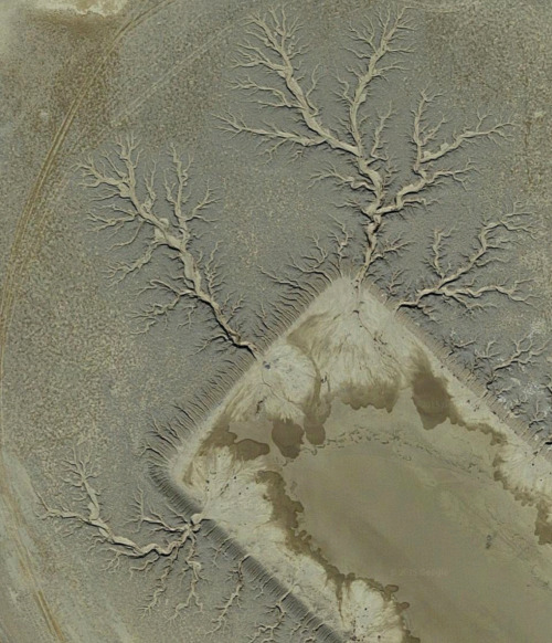
aerial photography
satellite view
abstract pattern
topography
contour lines
landscape
monochrome
texture
geological pattern
sinuous lines
Daily Overview
aerial photography
industrial landscape
residential area
storage tanks
oil depot
urban planning
top-down view
cityscape
infrastructure
land use
Daily Overview
aerial view
pink salt pans
geometric pattern
salt evaporation ponds
top-down perspective
abstract landscape
rectangular plots
pink water
salt production
aerial photography
Daily Overview
skydiver
skydiving
action cameras
extreme sports
helmet
airplane
adventure
parachuting
aerial photography
equipment
rachelbinx
aerial photography
satellite imagery
industrial landscape
evaporation ponds
salt mine
magenta ponds
top-down view
abstract landscape
mining facility
patterned terrain
Daily Overview
aerial photography
land art
large scale portrait
drone shot
art installation
landscape art
field
rural landscape
monochrome portrait
bird's eye view
Notational