notes.husk.org/likes
images.
tagged topography.
page 1 of 3 with 66 images.
lunar landscape
moon surface
craters
mountains
space
astronomy
monochrome
planetary
cosmic
topography
STML
3 images
woman
book
bridge
newcastle
london
map
cartography
street map
urban geography
topography
Electricity
abstract
minimalist
black and white
wavy lines
pattern
monochrome
graphic art
linear
topography
modern art
i like things
aerial view
winding road
rugged terrain
desert landscape
curvy road
landscape photography
arid landscape
topography
road trip
nature
Tecznts
abstract
digital art
topography
line art
generative art
black and gold
landscape
minimalist
geometric
terrain
Tecznts
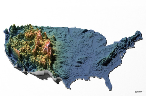
3d map
united states
topography
voxel art
data visualization
geography
digital art
terrain
elevation
usa
Our Melancholy Menagerie
google maps
iceland
mapping
geography
technology
comparison slider
topography
digital cartography
landscape
web design
koanstudy
aerial view
satellite imagery
farmland
agriculture
geometric pattern
landscape
topography
grid pattern
fields
mapping
Daily Overview
land art
earthwork
sculpture
landscape art
outdoor installation
environmental art
grassy mound
modern art
nature
topography
Dan W, Software Developer
line art
monochrome
abstract
topography
stippling
hatching
black and white
texture
pattern
ink drawing
Tecznts
satellite imagery
night lights
earth observation
remote sensing
geospatial
aerial view
urban landscape
day and night comparison
light patterns
topography
The New Aesthetic
9 images
notebook
stationery
abstract pattern
blue lines
minimalist design
topography
spiral
waves
paper
graphic art
just journals and reblogs
satellite imagery
aerial view
geological feature
crater
sand ripples
dunes
topography
landscape
black and white
texture
Dan W, Software Developer
map
california
nevada
grid overlay
data visualization
cartography
geography
topography
united states
spatial data
Tecznts
aerial photography
satellite view
agricultural land
water basin
geometrical pattern
canal
farmland
topography
rural scenery
landscape
Dan W, Software Developer
abstract texture
aerial landscape
grid collage
satellite imagery
nature patterns
earth tones
topography
fluid textures
digital montage
pattern collection
Notational
3 images
aerial view
mountains
cityscape
landscape
topography
urban sprawl
skyline
nature
high altitude
panoramic
Dan W, Software Developer
vintage map
antique map
scotland
cartography
topography
physical geography
historical map
highlands
geography
united kingdom
Activator / Inhibitor
cartography
urban planning
information design
topography
digital collage
aerial view
minimalist design
data visualization
graphic design
geography
Dan W, Software Developer
aerial view
satellite imagery
mountain peak
volcano
snow-capped
glaciers
landscape
nature
topography
alpine
Daily Overview
2 images
aerial view
satellite imagery
evaporation ponds
salt pans
mineral extraction
arid landscape
desert landscape
aerial photography
topography
abstract pattern
Dan W, Software Developer
2 images
london
map
russian language
street map
cartography
topography
united kingdom
city map
urban geography
atlas
STML
aerial view
satellite imagery
archipelago
coastline
islands
ocean
coastal landscape
blue water
bay
topography
Dan W, Software Developer
map
urban planning
transit network
transportation map
metropolitan area
topography
infrastructure
cartography
route map
city planning
hyperreal cartography & the unrealized city