notes.husk.org/likes
images.
tagged topography.
page 3 of 3 with 71 images.
aerial view
arid terrain
desert
earth tones
erosion patterns
geology
satellite imagery
terrain texture
topography
TO INFINITY & BEYOND
3d landscape
cartography
geometric
layered paper art
mountain range
paper sculpture
papercraft
relief model
topographical map
topography
Tecznts
aerial view
bay
coastline
estuary
geography
inlets
nature
ocean
satellite imagery
topography
Landsat
aerial view
coastline
geography
landscape
nature
ocean
satellite imagery
shoreline
topography
Landsat
aerial view
archipelago
clouds
earth
islands
landscape
nature
ocean
satellite imagery
topography
Landsat
borders
cartography
disclaimer
geography
google maps
map
navigation
roadmap
topography
uk government
Lee's Notepad
6 images
aerial view
cartography
geography
google earth
landscapes
map view
satellite imagery
topography
urban areas
Notational
cartography
digital elevation model
drainage basin
geography
hydrology
landscape
river network
topography
waterways
Tecznts
aerial view
landscape
meandering river
nature patterns
oxbow lakes
river bends
satellite imagery
sinuous
topography
waterways
Col. Chris Hadfield
aerial view
airstrip
desert
desert terrain
natural patterns
sand dunes
sand patterns
satellite imagery
topography
The New Aesthetic
bathymetric map
cartography
crater lake
geography
lake
map
national park
oregon
topographical map
topography
Dan W, Software Developer
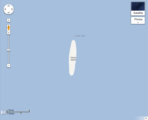
cartography
coral sea
geography
map
maritime
navigation
ocean
sandy island
topography
The New Aesthetic
aerial view
agriculture
false color
hydrology
landscape
meandering river
pattern
satellite imagery
topography
Dan W, Software Developer
3d map
aerial view
digital mapping
earthwork
excavation
landscape
river
satellite imagery
topography
The Amazing iOS 6 Maps
aerial view
cartography
cityscape
collage
geographic patterns
mosaic
satellite imagery
topography
urban planning
Dan W, Software Developer
4 images
3d surface modeling
cartography
digital elevation model
digital terrain model
spatial data
terrain modeling
tin
topography
triangulated irregular network
spazieren
aerial view
astronomy
black and white
cartography
geology
moon
mosaic
scientific documentation
topography
usgs
black and white
cartography
engraving
historical map
maritime
new york harbor
old document
topography
topography
Spio
4 images
3d map
data visualization
digital art
earth
globe
low poly
three.js
topography
voxel art
world map
Notational
aerial view
coastline
island
landscape
nature
ocean
satellite imagery
seascape
topography
the satellite tourist
aerial view
arctic
earth from space
glacier
icebergs
mountains
ocean
polar landscape
satellite imagery
topography
the satellite tourist
aerial view
buescher state park
hidden text
lake thunderbird
land art
landscape
luecke
nature typography
satellite imagery
topography
the satellite tourist