notes.husk.org/likes
images.
similar to
119802528811
.
24 images, most alike first.
insar
satellite interferometry
ground deformation
remote sensing
geophysics
earth science
seismic activity
radar imagery
geodesy
displacement map
Dan W, Software Developer
bathymetry
ocean floor
seamount
underwater topography
oceanography
geology
3d map
maritime science
sea floor
data visualization
BruceS
7 images
3d
map
mapping
maps
threejs
three.js
location
contour
isometric
visualization
data visualization
data viz
dataviz
data
san francisco
sf
datahacker
2 images
topography
3d terrain
digital elevation model
cartography
landscape
path
relief map
geospatial visualization
mesh
black and white
satellite imagery
aerial view
coastline
ocean
shoreline
nature
landscape
geography
topography
Landsat
3d map
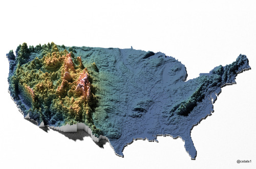
united states
topography
voxel art
data visualization
geography
digital art
elevation
usa
Our Melancholy Menagerie
satellite imagery
islands
cloud cover
ocean
aerial view
meteorology
nature
geography
Tupperwolf
Tecznts
world map
geology
plate tectonics
cartography
earth science
data visualization
geoscience
tectonic plates
scientific map
geography
Notational
topographic map
cartography
shaded relief
terrain map
physical map
geography
landscape map
digital cartography
map design
relief map
Tecznts
3 images
web
tech
terrain
cartography
physics
elastic
animation
webgl
prosthetic knowledge
4 images
cartography
topography
tin
digital elevation model
digital terrain model
triangulated irregular network
spatial data
terrain modeling
3d surface modeling
spazieren
space age
satellite
ground support
earth
macro
nature
Satellite Delight
satellite imagery
aerial view
coastline
ocean
bay
estuary
geography
nature
inlets
topography
Landsat
4 images
atmospheric science
remote sensing
satellite imagery
iss cats
cloud observation
aerosol detection
lidar
meteorology
data visualization
Dan W, Software Developer
2 images
bjork
island
islands
iceland
bjork island
nature
fav
Satellite Delight
mountains
glacier
aerial view
satellite imagery
route
alpine landscape
path
snowy peaks
topography
navigation
The New Aesthetic
6 images
australia
geometry
geography
architecture
modified
?
fav
Satellite Delight
2 images
volcano
bolivia
nature
geology
geography
fav
Satellite Delight
2 images
gif
gifs
climate
earth
climate change
ted
ted talks
IDEAS WORTH SPREADING
new york city
heatmap
data visualization
urban planning
geography
urban density
cartography
cityscape
Notational
aerial view
satellite imagery
meandering river
salt flats
estuary
mudflats
abstract landscape
top-down view
river delta
earth tones
Advanced Methods for Geospatial Image Analysis
aerial view
terraced landscape
agriculture
topography
nature
pattern
rice terraces
abstract
black and white
landscape
Notational
hydrology
river network
drainage basin
topography
cartography
geography
digital elevation model
waterways
landscape
Tecznts