notes.husk.org/likes
images.
similar to image 1 of
13549684336
.
24 images, most alike first.
maps
subways
historical
new york city
Department of Design
san francisco
bart
unbuilt subway
1960
urban planning
transit
subway
hyperreal cartography & the unrealized city
prospect park
brooklyn
cartography
historical map
city map
urban planning
cadastral map
landscape map
Tecznts
nautical chart
hydrographic chart
johnston island
cartography
marine map
island map
bathymetry
navigation chart
coastal map
maritime map
Scarpbook
topographic map
historical map
california
los angeles
cartography
usgs
geography
san fernando valley
BATTERED SHOES
3 images
historical map
puget sound
washington state
seattle area
bainbridge island
infrastructure planning
cartography
proposed bridges
pacific northwest
hyperreal cartography & the unrealized city
4 images
seattle map
historical map
urban planning
olmsted plan
transit map
vintage cartography
seattle history
municipal plans commission
green lake seattle
hyperreal cartography & the unrealized city
urban planning
city
map
hartford
conneticut
hyperreal cartography & the unrealized city
political cartoon
london history
landlordism
economic inequality
social criticism
housing reform
vintage illustration
anti-landlord propaganda
historical map
social reform
psd
cooch behar
map
enclaves
india
pakistan
historical map
border
west bengal
cartography
indo-pak border
STML
historical map
san francisco history
vintage cartography
california gold rush
19th century
yerba buena
urban history
old san francisco
california history
fuck yeah cartography!
google books
digitization
art
lit
tech
books
map
cartography
folded
chicago
obscured
rare books
old books
library
libraries
book arts
The Art of Google Books
scientific illustration
technical drawing
vintage illustration
numerical diagram
anatomical study
segmented structure
schematic drawing
mathematical diagram
morphology
scientific print
Notational
milton keynes
mkuv
Milton Keynes: Utopian Vision
8 images
san francisco
architecture
topography
urban planning
cartography
grid system
cityscape
urban morphology
graphic design
fuck yeah cartography!
historical diagram
balloon flight path
vintage graph
altitude chart
scientific illustration
flight trajectory
aeronautics history
monochrome print
meteorological data
old print
STML
historical document
world war ii
the blitz
war damage
diagram
london blitz
civil engineering
military map
archive
1940
Dan W, Software Developer
5 images
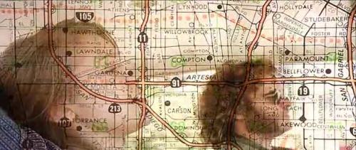
movie still
double exposure
flood
cinematic
los angeles map
superimposition
disaster
submerged
visual effects
Buzz Andersen
art
visual poetry
analog
artists on tumblr
abstract art
iida
aerial view
black and white
grainy
landscape
vintage
top-down view
texture
abstract
Dan W, Software Developer
map
urban planning
transit network
transportation map
metropolitan area
topography
infrastructure
cartography
route map
hyperreal cartography & the unrealized city
new york harbor
cartography
historical map
engraving
maritime
topography
black and white
old document
imperial valley
centinela
el centro
jetski
prison
google satellite
the satellite tourist