notes.husk.org/likes
images.
similar to
31923656357
.
24 images, most alike first.
satellite imagery
night lights
remote sensing
cartography
aerial view
cityscape
day and night comparison
light patterns
topography
The New Aesthetic
4 images
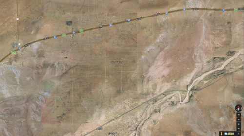
arizona
sun valley
urbanism
grids
hautepop
weather
radar
mayflies
Cloud Floating in the Blue
3 images
web
tech
terrain
cartography
physics
elastic
animation
webgl
prosthetic knowledge
aerial view
satellite imagery
cityscape
top-down view
vacant lots
real estate
urban planning
suburban area
land use
property maps
Notational
2 images
london
map
russian language
street map
cartography
topography
united kingdom
city map
urban geography
atlas
STML
6 images
australia
geometry
geography
architecture
modified
?
fav
Satellite Delight
satellite imagery
aerial view
collage
cityscape
mosaic
cartography
topography
geographic patterns
urban planning
Dan W, Software Developer
life
what is this even
landsat
chernobyl
gif
Pappus' plane 2
google search
mapquest
2001
retro internet
digital maps
cartography
internet history
vintage web
search engine
web design
Tecznts
satellite imagery
land art
luecke
aerial view
buescher state park
lake thunderbird
nature typography
topography
hidden text
landscape
the satellite tourist
aerial view
3d map
topography
landscape
satellite imagery
digital mapping
earthwork
excavation
river
The Amazing iOS 6 Maps
map
united states
traffic
highway
roads
navigation
midwest
us map
congestion
transportation
The New Aesthetic
3 images
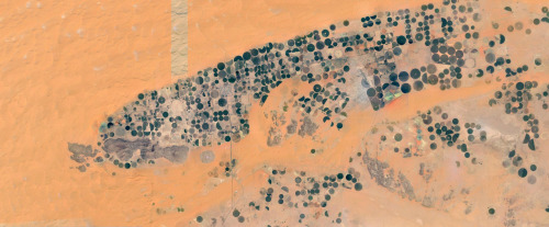
farms
farm life
saudi arabia
desert
orange
man made
Satellite Delight
map
california
nevada
grid overlay
data visualization
cartography
geography
topography
united states
spatial data
Tecznts
3 images
map
cartography
data visualization
night mode map
digital map
urban map
street map
geography
gis visualization
The New Aesthetic
6 images
aerial view
building segmentation
cityscape
urban analysis
3d reconstruction
data visualization
new york city
geospatial data
computer vision
digital twin
Notational
gis
google maps engine
mapping
waiting
Mapnostic
map
cartography
software interface
digital mapping
layers
data visualization
map design
vector graphics
Dan W, Software Developer
2 images
satellite imagery
aerial view
agriculture
crop fields
geometric pattern
irrigation
landscape
land use
mosaic pattern
Fresser.
10 images
urban planning
cartography
park accessibility
land use
urban greenery
public space
environmental mapping
spatial analysis
Notational
aerial view
satellite imagery
agriculture
geometric pattern
landscape
topography
grid
fields
cartography
Daily Overview
cartography
urban planning
topography
collage
aerial view
minimalism
data visualization
graphic design
geography
Dan W, Software Developer