notes.husk.org/likes
images.
similar to
44821485345
.
24 images, most alike first.
google search
mapquest
2001
retro internet
digital maps
cartography
internet history
vintage web
search engine
web design
Tecznts
2 images
road
swerve
beach
sand
wanderlust
manmade
Satellite Delight
3 images
historical map
puget sound
washington state
seattle area
bainbridge island
infrastructure planning
cartography
proposed bridges
pacific northwest
hyperreal cartography & the unrealized city
aerial view
satellite imagery
suburban landscape
residential area
housing development
top-down view
urban planning
neighborhood
infrastructure
street pattern
Daily Overview
2 images
silicon valley
palo alto
santa clara
stanford
1980s
board game
technology
jenny odell
3 images
map
cartography
data visualization
night mode map
digital map
urban map
street map
geography
gis visualization
The New Aesthetic
6 images
aerial view
top-down view
patterns
infrastructure
transportation
symmetry
geometric pattern
cityscape
logistics
scale
hyperreal cartography & the unrealized city
hybrid
submission
The Amazing iOS 6 Maps
aerial view
satellite imagery
cityscape
top-down view
vacant lots
real estate
urban planning
suburban area
land use
property maps
Notational
gta
gta v
map
video game
rockstar
hyperreal cartography & the unrealized city
aerial view
highway
traffic
road
cars
satellite imagery
cityscape
infrastructure
motorway
top-down view
the satellite tourist
bay bridge
cycling
key system
san francisco bay
caltrans
jamisonwieser.blog
3 images
hyperreal cartography & the unrealized city
6 images
aerial view
building segmentation
cityscape
urban analysis
3d reconstruction
data visualization
new york city
geospatial data
computer vision
digital twin
Notational
satellite imagery
aerial view
residential area
suburban neighborhood
housing development
street map
urban planning
houses
top-down view
neighborhood layout
the satellite tourist
landsat
chernobyl
gif
Pappus' plane 2
urban planning
landscape architecture
master plan
site plan
aerial view
green infrastructure
waterfront development
cityscape
urban regeneration
Tecznts
new york city
heatmap
data visualization
urban planning
geography
urban density
cartography
cityscape
Notational
london 2012 olympics
north greenwich arena
event logistics
river thames
olympic games
urban planning
blackwall tunnel
event management
london map
transportation network
Dan W, Software Developer
satellite imagery
aerial view
collage
cityscape
mosaic
cartography
topography
geographic patterns
urban planning
Dan W, Software Developer
aerial view
open-pit mine
quarry
satellite imagery
terraced landscape
mining site
earthworks
topography
industrial landscape
excavation
Tecznts
3 images
tech
design
computer vision
cars
google
prosthetic knowledge
4 images
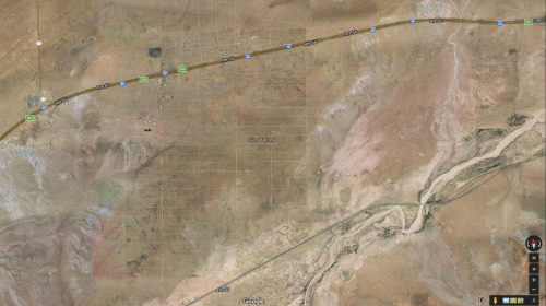
arizona
sun valley
urbanism
grids
hautepop
pneumatic tube mail
postal history
new york city history
historical map
manhattan geography
mail delivery system
data visualization
urban infrastructure
postal network
historical transportation
Mapnostic