notes.husk.org/likes
images.
similar to
56604076367
.
24 images, most alike first.
Tecznts
8 images
united states map
gis mapping
spatial analysis
linguistic patterns
heatmaps
getis-ord gi*
z-score
geographic distribution
word usage
regional patterns
STML
5 images
font
typography
numeric
decimal
data
visualization
visual
number
prosthetic knowledge
alaska
map
united states
geography
data visualization
north america
educational
demographics
climate
bering sea
Tupperwolf
data visualization
network
connectivity
map
usa
transportation
logistics
infrastructure
interconnectedness
cartography
psd
2 images
google maps
google
government
POLITICO
map
california
nevada
grid overlay
data visualization
cartography
geography
topography
united states
spatial data
Tecznts
new spain
colony
mexico
usa
hyperreal cartography & the unrealized city
7 images
sea level rise
climate change
global warming
environmental science
geography
flooding
earth science
oceanography
maps
future earth
hyperreal cartography & the unrealized city
us migration map
california
population movement
demographic trends
data visualization
united states
net migration
internal migration
population statistics
i like things
map
world map
global arms
weapons
exporting
international
maps
importing
world
international global
global
map
united states
usa
topographic map
road map
geography
cartography
north america
wall art
highways
Notational
partition of germany
geopolitics
political science
cold war
historical map
analogy
west germany
east germany
united states
great britain
hyperreal cartography & the unrealized city
us migration patterns
united van lines
data visualization
moving trends
united states map
population movement
heatmap
demographics
migration statistics
Fresser.
aviation map
flight information regions
airspace boundaries
air traffic control
eurocontrol
europe map
air traffic management
aviation navigation
flight information region
upper information region
STML
map
north america
united states
data visualization
red dots
geographic distribution
usa
cartography
spatial data
MarkMemmottNPR
10 images
urban planning
cartography
park accessibility
land use
urban greenery
public space
environmental mapping
spatial analysis
Notational
weather
radar
mayflies
Cloud Floating in the Blue
gis
google maps engine
mapping
waiting
Mapnostic
maps
geography
united states
rain
weather
Maps on the Web
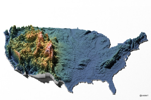
3d map
united states
topography
voxel art
data visualization
geography
digital art
elevation
usa
Our Melancholy Menagerie
maps
projections
Maps on the Web
united states map
data visualization
minimalism
us states
green and white
statistical graphic
flat design
map of usa
state statistics
Tecznts
arpanet
internet history
computer networking
united states map
network topology
history of computing
early internet
digital history
1969
technology history
Tecznts