notes.husk.org/likes
images.
similar to
80006846320
.
24 images, most alike first.
satellite imagery
california
fog
mountains
ocean
aerial view
coastline
landscape
nature
Dan W, Software Developer
satellite imagery
aerial view
coastline
delta
river mouth
estuary
ocean
geography
landscape
nature
Landsat
satellite imagery
aerial view
coastline
ocean
bay
estuary
geography
nature
inlets
topography
Landsat
satellite imagery
aerial view
coastline
ocean
shoreline
nature
landscape
geography
topography
Landsat
satellite imagery
coastline
aerial view
ocean
clouds
landscape
nature
seascape
earth
greenery
Landsat
map
california
nevada
grid overlay
data visualization
cartography
geography
topography
united states
spatial data
Tecznts
aerial view
canyon
reservoir
landscape
nature
arid terrain
rocky cliffs
waterway
top-down view
desert
Daily Overview
hydrology
river network
drainage basin
topography
cartography
geography
digital elevation model
waterways
landscape
Tecznts
satellite imagery
aerial view
icebergs
glacier
arctic
polar landscape
mountains
ocean
topography
earth from space
the satellite tourist
satellite imagery
islands
cloud cover
ocean
aerial view
meteorology
nature
geography
Tupperwolf
aerial view
satellite imagery
archipelago
coastline
islands
ocean
blue water
bay
topography
Dan W, Software Developer
satellite imagery
islands
ocean
clouds
aerial view
earth
nature
archipelago
topography
landscape
Landsat
5 images
i love this city
my home (even if i continue to feel like unwelcome 'techie scum')
adore how crisp and bright this picture is -- you can see my apartment!
Simply Sithel
Tupperwolf
great lakes
satellite imagery
winter
north america
snow cover
geography
aerial view
cloud cover
meteorology
rachelbinx
visualization
data visualization
dataviz
d3
polymaps
qgis
maps
mapping
map
cartography
location
oakland
foreclosures
datahacker
topographic map
cartography
shaded relief
terrain map
physical map
geography
landscape map
digital cartography
map design
relief map
Tecznts
sea the future
sea
ocean
seafloor
mapping
usgs
science
california
Future of Science
7 images
sea level rise
climate change
global warming
environmental science
geography
flooding
earth science
oceanography
maps
future earth
hyperreal cartography & the unrealized city
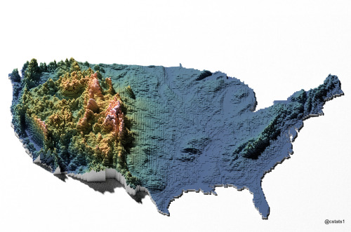
3d map
united states
topography
voxel art
data visualization
geography
digital art
elevation
usa
Our Melancholy Menagerie
3 images
web
tech
terrain
cartography
physics
elastic
animation
webgl
prosthetic knowledge
california history
bicycle history
antique advertising
cycling
vintage illustration
california coast
historical map
bicycling
typography
Tecznts
satellite imagery
night lights
remote sensing
cartography
aerial view
cityscape
day and night comparison
light patterns
topography
The New Aesthetic
6 images
australia
geometry
geography
architecture
modified
?
fav
Satellite Delight