notes.husk.org/likes
images.
similar to
85234903479
.
24 images, most alike first.
8 images
aerial view
satellite imagery
industrial landscape
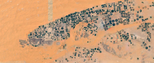
agricultural fields
shipping containers
evaporation ponds
salt pans
geometric pattern
landscape
Notational
aerial view
satellite imagery
desert
top-down view
paved tracks
geometric pattern
arid environment
infrastructure
minimalist composition
desert terrain
Daily Overview
aerial view
satellite imagery
industrial landscape
evaporation ponds
salt mine
magenta ponds
top-down view
abstract landscape
mining facility
patterned terrain
Daily Overview
9 images
aerial view
oil pumpjack
satellite imagery
desert
industrial landscape
oil extraction
arid terrain
top-down view
energy industry
earth tones
Notational
6 images
aerial view
satellite imagery
salt evaporation ponds
salt flats
abstract patterns
landscape
earth tones
salt pans
top-down view
mineral deposits
hyperreal cartography & the unrealized city
green
golf course
desert
lonely road
maps
Satellite Delight
aerial view
satellite imagery
evaporation ponds
salt flats
desert
mineral extraction
pattern
top-down view
lithium mining
Dan W, Software Developer
2 images
aerial view
satellite imagery
evaporation ponds
salt pans
mineral extraction
arid landscape
desert
topography
pattern
Dan W, Software Developer
aerial view
sand dunes
desert
satellite imagery
topography
sand patterns
desert terrain
natural patterns
airstrip
The New Aesthetic
3 images
aerial view
agriculture
irrigation
crop rows
geometric pattern
satellite imagery
land use
textures
farming patterns
Notational
river
desert
farm
cartography
maps and atlases
fav
manmade
Satellite Delight
aerial view
agriculture
farming
crops
green fields
desert
geometric pattern
top-down view
cultivation
irrigation
Daily Overview
7 images
landscape
science
Designer | Curator | Brother
3 images
farms
farm life
saudi arabia
desert
orange
man made
Satellite Delight
3 images
aerial view
mountains
cityscape
landscape
topography
urban sprawl
skyline
nature
high altitude
panoramic
Dan W, Software Developer
aerial view
highway interchange
road
infrastructure
geometric pattern
top-down view
overpass
arid landscape
urban planning
transportation
Daily Overview
glitch art
abstract
digital art
fragmented
geometric pattern
deconstructed landscape
texture
earthy tones
modern art
STML
aerial view
satellite imagery
desert
geometric pattern
top-down view
man-made structures
symmetry
arid terrain
architectural layout
Daily Overview
aerial view
satellite imagery
center-pivot irrigation
agriculture
arid landscape
irrigation patterns
crop fields
desert agriculture
The New Aesthetic
aerial view
satellite imagery
agricultural land
water basin
geometrical pattern
canal
agriculture
topography
rural scenery
landscape
Dan W, Software Developer
2 images
geology
geography
island
rocks
beach
natural
Satellite Delight
aerial view
pink ponds
solar panels
solar farm
evaporation ponds
landscape
drone shot
industrial landscape
top down view
Daily Overview
aerial view
bridge
causeway
ocean
desert
minimalism
coastline
top-down view
landscape
Daily Overview
aerial view
landscape
salt flats
desert
mineral deposits
turquoise water
top-down photography
nature
geology
abstract landscape
Daily Overview