notes.husk.org/likes
images.
tagged geography.
page 3 of 4 with 75 images.
map
asia
oceania
connectivity
travel routes
logistics
geography
data visualization
shipping lanes
flight paths
jomc.links
gis
maps
geography
timezone
cartographers without borders
map
africa
geography
hydrology
rivers
lakes
diagram
cartography
line drawing
black and white
hyperreal cartography & the unrealized city
world map
geology
plate tectonics
cartography
earth science
data visualization
geoscience
tectonic plates
scientific map
geography
Notational
scotland
map
google maps
highlands
west coast
islands
geography
isle of skye
united kingdom
coastline
Fresser.
satellite imagery
aerial view
coastline
delta
river mouth
estuary
ocean
geography
landscape
nature
Landsat
satellite imagery
aerial view
coastline
ocean
bay
estuary
geography
nature
inlets
topography
Landsat
satellite imagery
aerial view
coastline
ocean
shoreline
nature
landscape
geography
topography
sea
Landsat
satellite imagery
islands
cloud cover
ocean
aerial view
earth observation
meteorology
sea
nature
geography
Tupperwolf
aerial view
satellite imagery
3d mapping
bay
coastline
geography
maritime
landscape
waterway
infrastructure
The New Aesthetic
google maps
map
geography
disclaimer
uk government
cartography
navigation
roadmap
topography
borders
Lee's Notepad
topographic map
cartography
shaded relief
terrain map
physical map
geography
landscape map
digital cartography
map design
relief map
Tecznts
6 images
satellite imagery
google earth
aerial view
aerial photography
geography
geospatial
topography
map view
landscapes
urban areas
Notational
historical maps
age of exploration
world history
cartography
geography
timeline
exploration
infographic
global history
discovery
BruceS
hydrology
river network
drainage basin
topography
cartography
geography
terrain
digital elevation model
waterways
landscape
Tecznts
san francisco
topographic map
cartography
data visualization
urban planning
elevation map
contour lines
cycling routes
geography
minimalist art
new york city
manhattan
heatmap
data visualization
urban planning
geography
urban density
gis
cartography
urban landscape
Notational
aerial view
san francisco bay
coastline
cityscape
bay area
urban landscape
satellite imagery
bridges
ocean
geography
tumblr spum
crater lake
topographical map
bathymetric map
cartography
oregon
geography
national park
lake
terrain
map
Dan W, Software Developer
population density
infographic
usa population
urban planning
data visualization
sustainability
geography
urbanization
mass transit
environmental impact
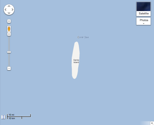
markasaurus
sandy island
coral sea
map
geography
cartography
ocean
sea
maritime
navigation
topography
The New Aesthetic
map
islands
archipelago
geography
minimalist
sea
ocean
cartography
illustration
blue
The New Aesthetic
map
geography
territorial dispute
east china sea
gps coordinates
navigation
digital map
ipad screenshot
cartography
island chain
Dan W, Software Developer
embossed map
vintage book
antique cartography
relief map
paper texture
southeastern united states
geography
embossing
monochrome
old book page
Fresser.